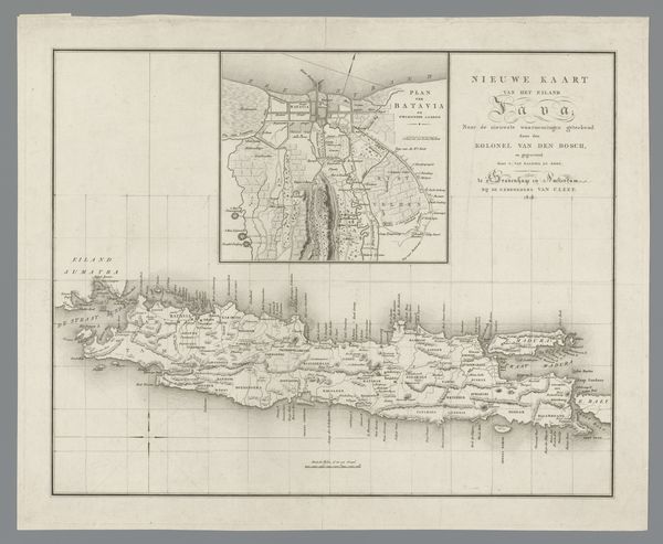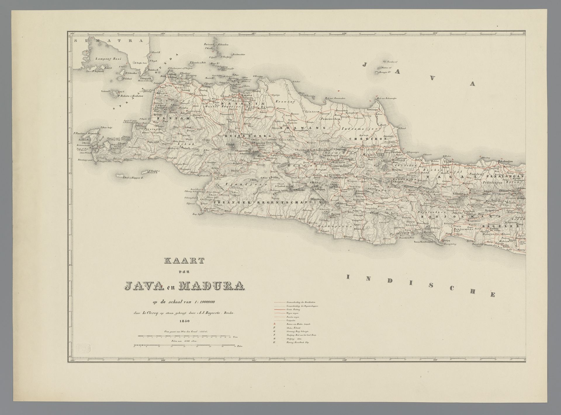
1850
Kaart van Java en Madoera, linkerdeel
Listen to curator's interpretation
Curatorial notes
Curator: So, here we have Adriaan Jan Bogaerts's "Kaart van Java en Madoera, linkerdeel", which translates to "Map of Java and Madura, left part", an engraving from 1850. It offers a glimpse into cartographic practices of the time, with detailed notations. Editor: It's so delicate, like a whispered secret from a bygone era. All those tiny details... it almost feels like I could get lost just staring at it. The pale gray tones evoke a feeling of nostalgia, of journeys planned and histories unfolding. Curator: Absolutely. Think about the socio-economic context in which this map was produced. Who was it made for? The Dutch colonial administration would have found this incredibly valuable for resource extraction, trade routes and of course military operations. This wasn't a tool for exploration in the romantic sense; it was for governance and exploitation. Editor: The realism is stark. And even with its inherent colonial purpose, I see the artistry and immense effort required. It makes me think of the cartographers themselves – painstakingly etching those coastlines and plotting settlements with so much accuracy and discipline, the labor behind the craft. Curator: Precisely. And consider the materials. Paper itself becomes a loaded subject here—sourced, manufactured, printed with intention. Maps are never neutral objects; they are imbued with the power dynamics of their time. And here, a high-precision instrument turns this paper into a material tool. Editor: All those tiny lines. All those place names recorded by what? Who made those recordings? Curator: Another point entirely. It reminds us of the subjective interpretation embedded in even the most "objective" representations. And who benefits most from this particular rendering of reality? Editor: This map becomes something beyond just geography, then. Curator: Exactly! It's about labor, resource exploitation, colonial administration. That’s the essence of a materialist understanding— revealing layers through a focus on material production. Editor: So instead of feeling romantic nostalgia, it inspires a much richer, complex, troubled imagining. Curator: Exactly! And for me it encourages further investigation into colonial infrastructures of map-making and of course, that long-gone world itself.