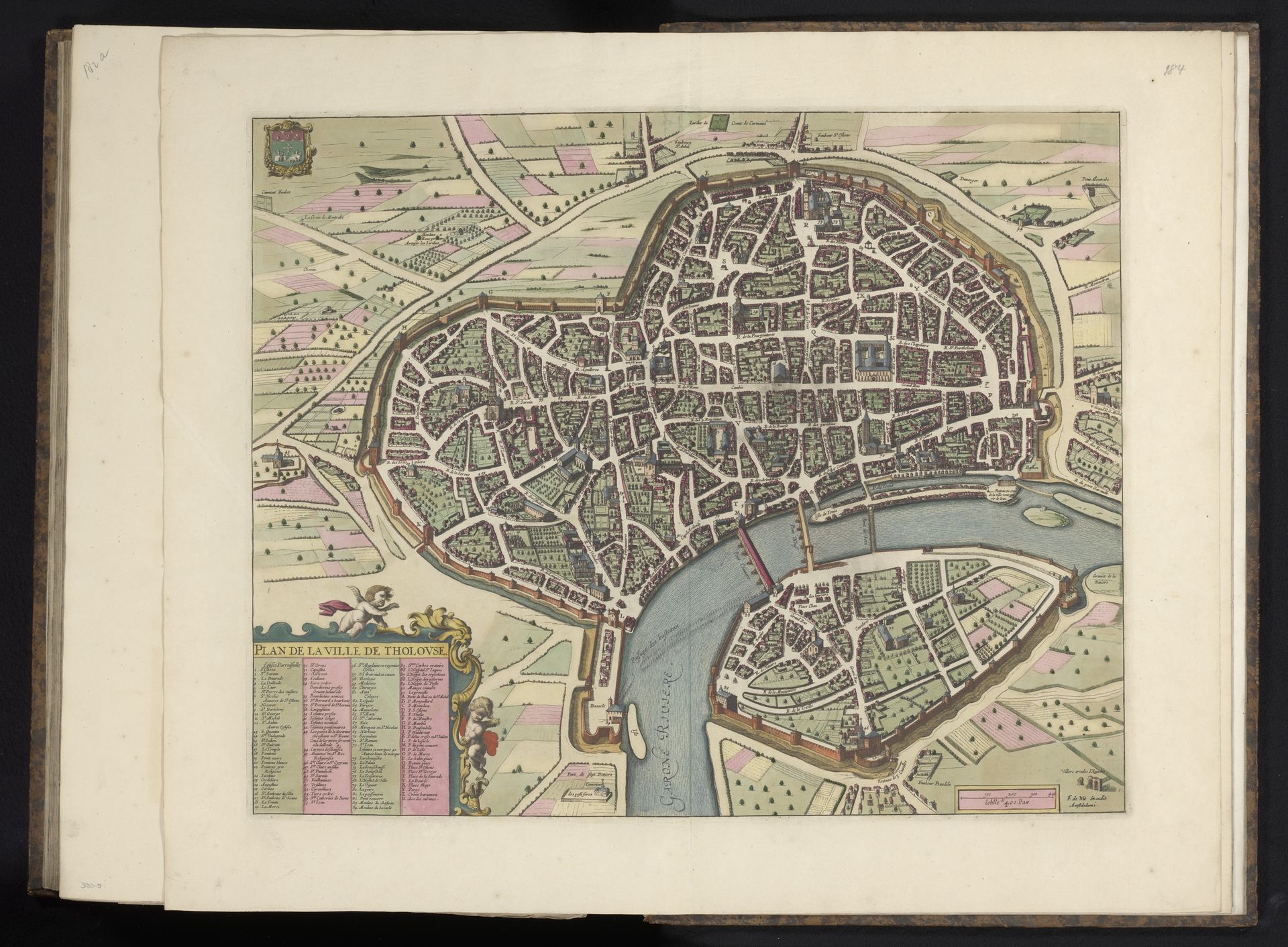
c. 1690 - 1695
Plattegrond van Toulouse
Anonymous
@anonymousLocation
RijksmuseumListen to curator's interpretation
Curatorial notes
This is an undated map of Toulouse, France, by an anonymous artist. Likely created during a period of significant urban and social change, maps such as these offered a bird's eye view of cities, reflecting both civic pride and strategic interests. Historically, urban maps often served purposes beyond mere navigation; they functioned as tools of power and control. In a society deeply structured by class and social hierarchies, maps could delineate boundaries and assert dominance. Note how the detailed rendering of the city's fortifications, buildings, and infrastructure emphasizes order and control. Consider the map's emotional resonance. It is a blend of artistry and information, where lines and colors coalesce to evoke the complexities of urban life. Though anonymous, the artist's work preserves the emotional and social dimensions of the city for us to consider. How does this map influence our understanding of urban life and the role of anonymous artistry in shaping our perceptions of place and identity?