drawing, print, paper, ink, pen, engraving
drawing
aged paper
toned paper
light pencil work
baroque
sketch book
hand drawn type
paper
personal sketchbook
ink
pen-ink sketch
pen work
sketchbook drawing
pen
cityscape
sketchbook art
engraving
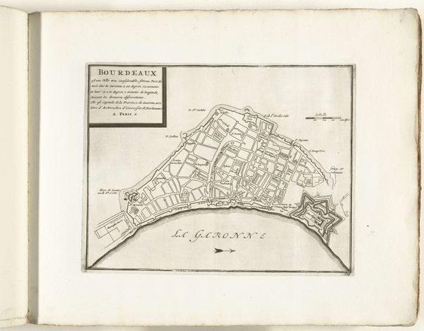
Dimensions: height 229 mm, width 288 mm
Copyright: Rijks Museum: Open Domain
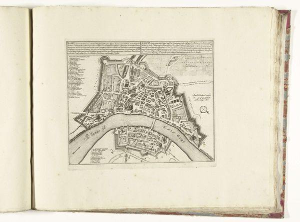
This is a map of Bordeaux, circa 1693-1696, created by an anonymous artist. A dominant symbol is the walled city itself. The act of enclosing and protecting a space reflects an ancient human impulse, appearing as far back as the walls of Jericho. Consider how the fortress, with its star-shaped bastions jutting into the Garonne, echoes earlier forms like the Roman castrum, designed for military control. These evolved into medieval citadels, reflecting a continuous need for security. Even today, we see echoes of these protective structures in modern urban planning. The very act of defining borders taps into a deep-seated need to secure space against perceived threats. This map, therefore, isn’t just a representation of Bordeaux; it’s a visual echo of humanity's recurring efforts to create order and safety in a chaotic world. The psychological impact of these forms remains potent, triggering feelings of security and control. This impulse cycles through time, resurfacing and evolving with each new era.
Comments
No comments
Be the first to comment and join the conversation on the ultimate creative platform.