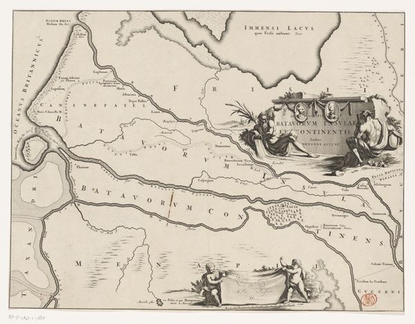
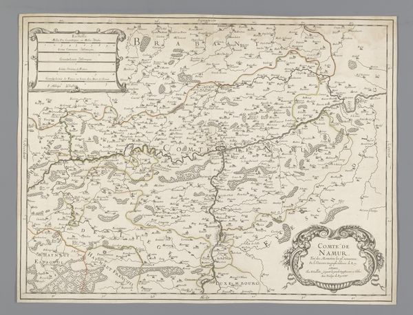
Historische kaart van Nederland met de gebieden van de Bataven en Friezen 1697 - 1725
0:00
0:00
print, engraving
#
dutch-golden-age
# print
#
landscape
#
history-painting
#
engraving
Dimensions: height 324 mm, width 420 mm
Copyright: Rijks Museum: Open Domain
Curator: This engraving, "Historical Map of the Netherlands with the territories of the Batavians and Frisians," created sometime between 1697 and 1725 by Gerrit de Broen, is really striking in its detail. The landscape is beautifully rendered, though it does feel somewhat distant. How would you approach this map? Editor: The title made me think of historical paintings. This map, a print, isn't like that though, it's very graphic in a technical kind of way. What interests me are the choices, for instance what gets included and what doesn't. What can you tell me about it? Curator: We must consider this as a material object that participated in and reflected the specific conditions of its production. It’s not just an objective document. Consider the engraving process itself – the labor involved in carving the image onto the plate. What does it mean that this ‘historical’ map was made at this specific time? Editor: Right, you mean who was commissioning these, and for what purpose. It couldn't have been a simple consumer product. Curator: Exactly! Maps like these played a role in shaping national identity and solidifying territorial claims. And how that engraving process creates standardized images accessible to a broad audience compared to the work involved in creating something unique for only one person. Can we even trust its depiction, is there inherent bias within its visual rhetoric and production that demands an accounting for when we look at the history on display? Editor: So the material, engraving, and the print allow this idea of nationhood to spread further and be reinforced. It makes me wonder if the style or skill in creating this has political value too. Is there a value assigned because of its appearance? Curator: Absolutely. The artistry evident in the engraving, the skillful rendering of landscapes and details, lends authority to the map. It transforms a functional object into a thing of beauty. This elevates its perceived importance, but we also have to be aware of the labour behind such items. We get so caught up in aesthetic considerations that we forget these items are still just a sum of labor. Editor: It’s fascinating how the process and materials directly inform the map's purpose and impact. I had never thought about maps that way before. Curator: It highlights how deeply intertwined the material conditions of art production are with the social and political forces shaping society. Considering the tangible existence of artifacts is always paramount when interpreting artworks.
Comments
No comments
Be the first to comment and join the conversation on the ultimate creative platform.
More like this