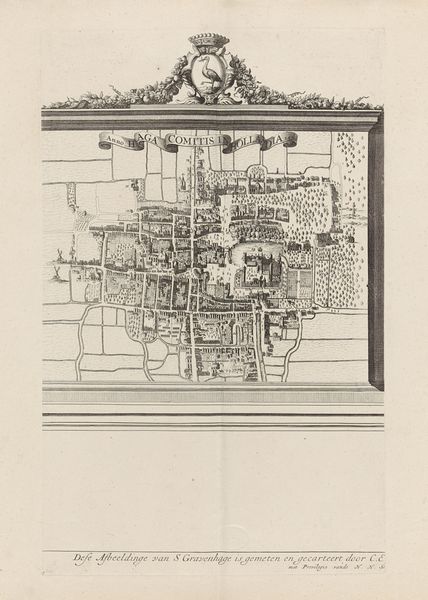
print, paper, engraving
#
baroque
#
dutch-golden-age
# print
#
paper
#
cityscape
#
engraving
Dimensions: height 152 mm, width 231 mm
Copyright: Rijks Museum: Open Domain
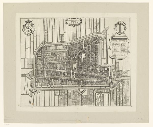
This is an early map of Delft, created anonymously using etching techniques. Delft, a city synonymous with the Dutch Golden Age, was a melting pot of trade, science, and art. Mapping at this time was less about objective geography, and more about asserting control and projecting power. Maps were tools of governance, influencing trade routes, military strategy, and urban development, and thus impacting the lives of everyone from merchants to marginalized communities. Look closely at the map’s detail: the meticulous rendering of streets and canals not only guided navigation but also shaped the social fabric of the city. Consider the experience of the mapmaker. What biases might be present in this representation of Delft? Does the ordering of space reinforce existing hierarchies, or does it offer alternative narratives? This map serves as a powerful reminder that even the most seemingly objective representations are imbued with the values and perspectives of their creators, with real impact on society.
Comments
No comments
Be the first to comment and join the conversation on the ultimate creative platform.
More like this