Dimensions: height 402 mm, width 535 mm
Copyright: Rijks Museum: Open Domain
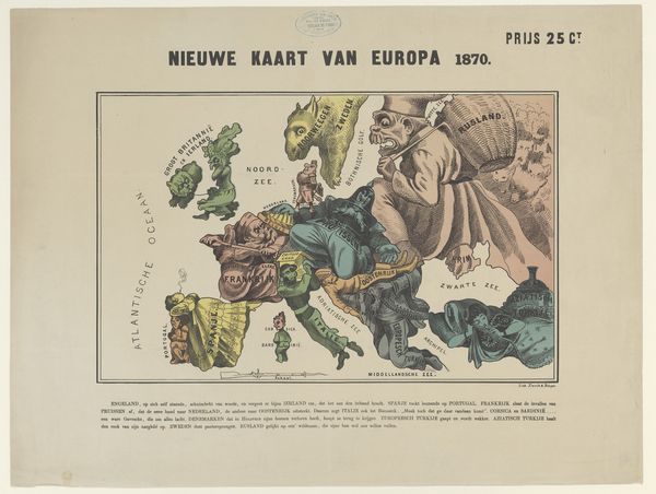
Emrik and Binger created this ‘Humorous Map of Europe 1870’ as a lithograph. It’s a snapshot of European political dynamics, caricatured through national stereotypes, reflecting a time of significant upheaval. Consider how each country is personified. We see Russia as a large, looming figure, and France as a wounded soldier, perhaps alluding to the Franco-Prussian War. These are not neutral depictions, they reflect the biases and anxieties of the period. Notice how identities are simplified. The map trades in national stereotypes, reducing complex societies to singular, often unflattering, traits. It's easy to dismiss this as mere historical humor, but this map reveals deeper truths about how nations perceive one another, and how stereotypes can shape political discourse. It's a reminder of the power of representation and the importance of critically examining the narratives we inherit. What does it mean to perform identity on a world stage?
Comments
No comments
Be the first to comment and join the conversation on the ultimate creative platform.
More like this