About this artwork
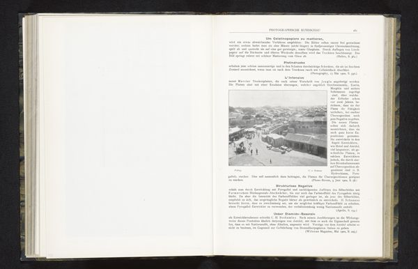
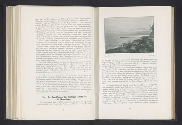
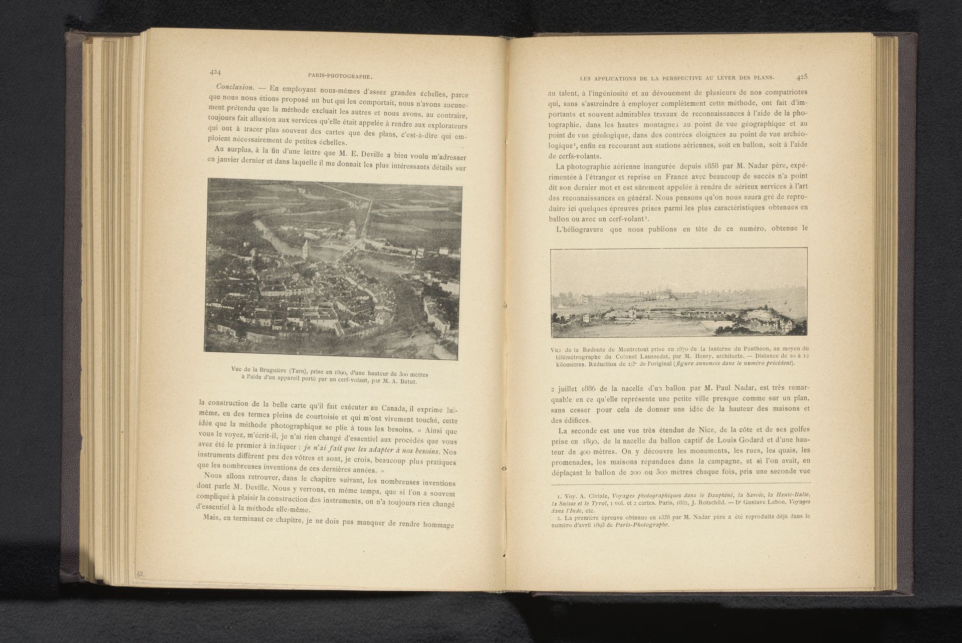
Arthur Batut made this aerial view of Bruguières in France using kite photography sometime in the late 19th or early 20th century. This image is part of a longer history in which institutions like the military and surveyors worked to develop techniques of mapping the world from above. Batut's photograph can be seen as a kind of democratization of this impulse, in which individual citizens could use technology to observe the world around them. The image invites us to consider the relationship between technology and the environment. We see a townscape, but one that is partially obscured by the technology used to capture it. Was Batut commenting on the rapid social changes brought about by technological progress? Understanding this image involves not only analyzing its visual elements but also researching the social and technological context in which it was created. Such work helps to illuminate the complex interplay between art, technology, and social change.
Artwork details
- Medium
- print, photography
- Dimensions
- height 82 mm, width 120 mm
- Copyright
- Rijks Museum: Open Domain
Tags
Comments
Share your thoughts
About this artwork
Arthur Batut made this aerial view of Bruguières in France using kite photography sometime in the late 19th or early 20th century. This image is part of a longer history in which institutions like the military and surveyors worked to develop techniques of mapping the world from above. Batut's photograph can be seen as a kind of democratization of this impulse, in which individual citizens could use technology to observe the world around them. The image invites us to consider the relationship between technology and the environment. We see a townscape, but one that is partially obscured by the technology used to capture it. Was Batut commenting on the rapid social changes brought about by technological progress? Understanding this image involves not only analyzing its visual elements but also researching the social and technological context in which it was created. Such work helps to illuminate the complex interplay between art, technology, and social change.
Comments
Share your thoughts