About this artwork
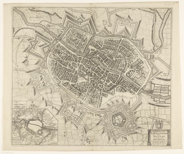
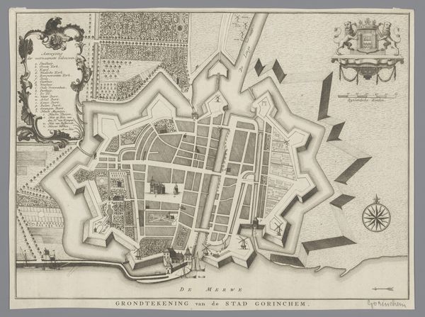
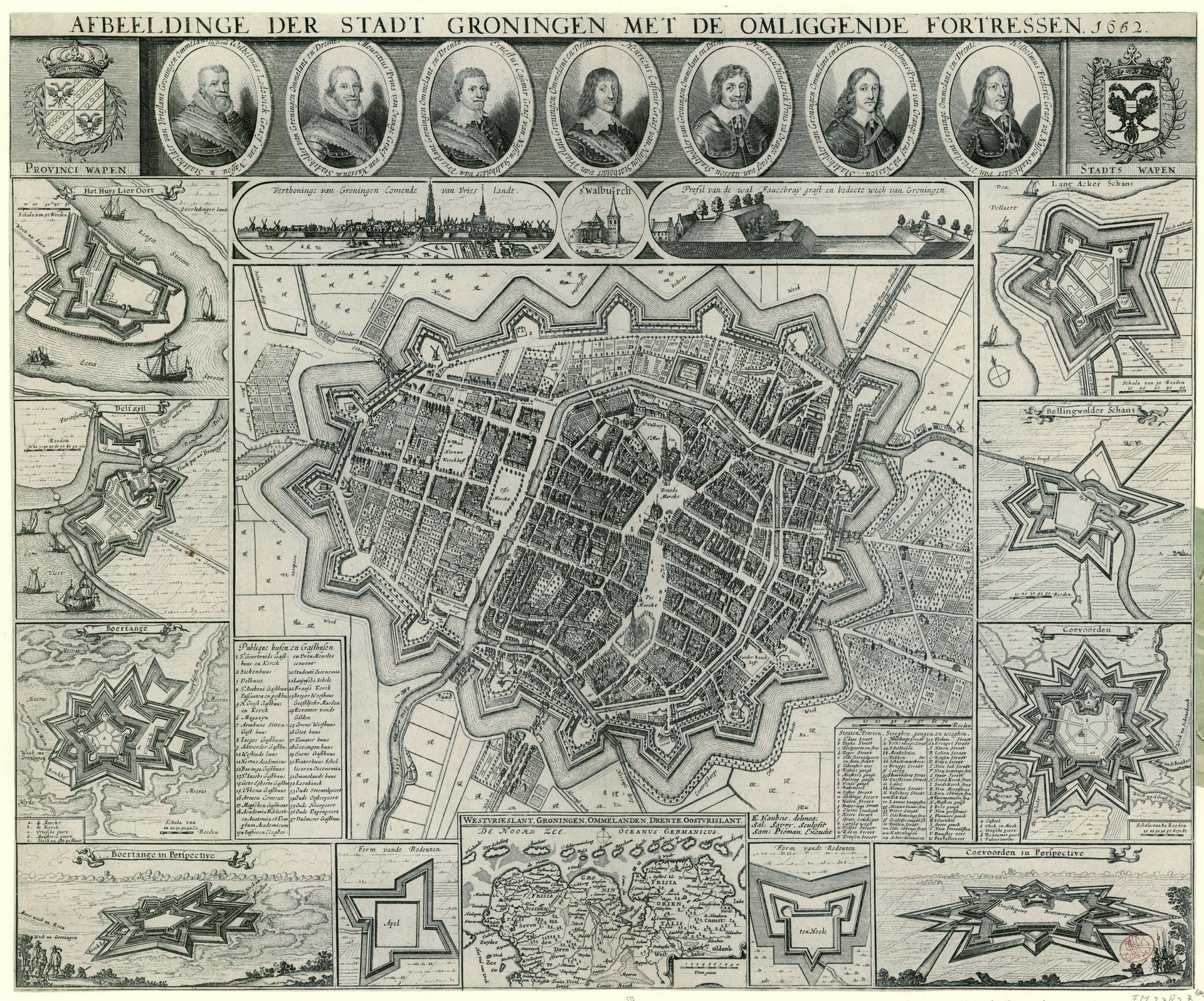
Salomon Savery rendered this detailed map of Groningen with etching around 1672, showcasing not just geography but also a powerful symbolic language of defense and governance. Notice the star-shaped fortresses surrounding the city, a common motif in the 17th century that is more than just practical architecture. These star forts—echoes of geometric perfection—symbolize the era's obsession with order and control. Think back to the Renaissance and its revival of classical ideals, where geometry was seen as divine. Now, consider how these shapes resonate with other historical symbols, like the mandala in Eastern traditions, each reflecting a quest for cosmic harmony and protection, yet diverging through time. It is clear that the underlying motif is the same. Here, the emotional and psychological weight is palpable: the desire to safeguard, to control chaos. This isn't just a map; it’s a statement about power, security, and the human drive to impose structure on a turbulent world. This cyclical dance of form and meaning reminds us that images never truly fade; they resurface, adapt, and continue to influence our collective psyche.
Artwork details
- Medium
- print, engraving
- Dimensions
- height 460 mm, width 555 mm, height 120 mm, width 200 mm
- Location
- Rijksmuseum
- Copyright
- Rijks Museum: Open Domain
Tags
Comments
Share your thoughts
About this artwork
Salomon Savery rendered this detailed map of Groningen with etching around 1672, showcasing not just geography but also a powerful symbolic language of defense and governance. Notice the star-shaped fortresses surrounding the city, a common motif in the 17th century that is more than just practical architecture. These star forts—echoes of geometric perfection—symbolize the era's obsession with order and control. Think back to the Renaissance and its revival of classical ideals, where geometry was seen as divine. Now, consider how these shapes resonate with other historical symbols, like the mandala in Eastern traditions, each reflecting a quest for cosmic harmony and protection, yet diverging through time. It is clear that the underlying motif is the same. Here, the emotional and psychological weight is palpable: the desire to safeguard, to control chaos. This isn't just a map; it’s a statement about power, security, and the human drive to impose structure on a turbulent world. This cyclical dance of form and meaning reminds us that images never truly fade; they resurface, adapt, and continue to influence our collective psyche.
Comments
Share your thoughts