print, engraving
#
aged paper
#
baroque
#
dutch-golden-age
# print
#
old engraving style
#
personal sketchbook
#
cityscape
#
history-painting
#
academic-art
#
engraving
Dimensions: height 155 mm, width 107 mm
Copyright: Rijks Museum: Open Domain
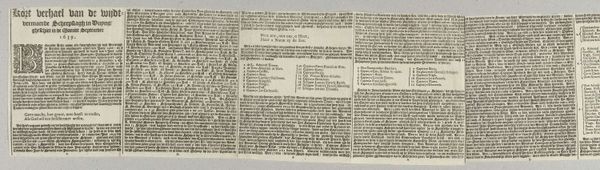
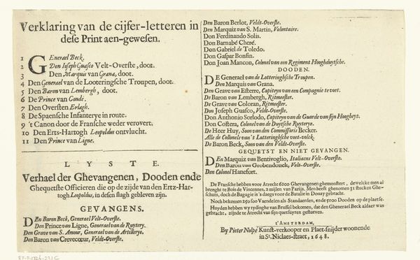
This key to a map of the siege of Londonderry was made in 1689 by an anonymous artist and details significant locations during the conflict. It’s a numbered list matching places on the map with their corresponding names; from churches to streets and strategic points. This document is a glimpse into a very specific and turbulent moment in Irish and British history, during the Williamite War. The siege of Londonderry was a major event in this war, a conflict largely framed by religious and political affiliations, pitting the Protestant Williamites against the Jacobites, who supported the Catholic King James. The key reflects the tensions of the time; it mentions locations of Protestant entrenchments but also notes the headquarters of the Irish, as the Jacobites were known at the time. It reveals how communities were divided and how urban spaces became theaters of war. Though the artist is anonymous, they were undoubtedly impacted by these events. It gives us not just names on a map, but a visceral sense of a city under siege, a community divided, and the human cost of conflict.
Comments
No comments
Be the first to comment and join the conversation on the ultimate creative platform.
More like this