print, paper, engraving
#
medieval
# print
#
paper
#
text
#
flemish
#
engraving
Dimensions: height 151 mm, width 195 mm
Copyright: Rijks Museum: Open Domain
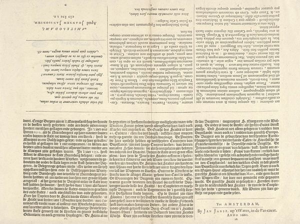
Frans Hogenberg created this map of Flanders around 1570 using engraving. It gives us insight into the politics of imagery during a period of conflict. Flanders, now part of Belgium, was then under Spanish rule. Hogenberg's map is more than just a geographical representation; it's a political statement. The detailed depiction of cities, rivers, and regions served to define and assert the identity of Flanders, a region struggling for independence. The inclusion of Latin text elevates the map to a scholarly level, aimed at an educated, international audience. Consider the role of institutions during this time. Mapmaking was often supported by powerful entities. Hogenberg's work reflects the growing sense of regional identity and resistance to foreign domination. To understand this map better, research into the history of cartography and the Dutch Revolt would be invaluable, revealing how art became a tool for shaping perceptions and challenging authority.
Comments
No comments
Be the first to comment and join the conversation on the ultimate creative platform.
More like this