Nouvelle Carte des Sept Departemens de la Hollande (...) / Nieuwe Kaart der Zeven Hollandsche Departementen. Verdeeld ingevolge het Decreet van Zijne Majesteit de Keizer en Koning van den 21 October 1811, met den Jare 1812 ingevoerd 1811 - 1812
0:00
0:00
jangerritszvisser
Rijksmuseum
print, engraving
#
map drawing
#
dutch-golden-age
# print
#
old engraving style
#
geometric
#
history-painting
#
engraving
Dimensions: height 656 mm, width 950 mm
Copyright: Rijks Museum: Open Domain
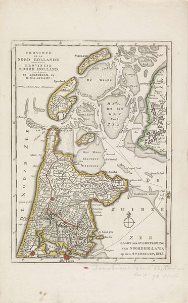
Jan Gerritsz. Visser created this map of the seven Dutch departments, likely around 1812. The map reflects a specific moment in Dutch history, during the Napoleonic era when the Netherlands was incorporated into the French Empire. It delineates the administrative divisions implemented by Napoleon's decree of 1811. The map serves as a tool of governance, illustrating how power and control were exerted over territories and populations. Note that the colors demarcate the departments, each with its administrative center, reflecting the restructuring of Dutch identity under French rule. Consider what it meant to redraw the boundaries of a nation, to re-categorize its people under a foreign power. The map invites us to reflect on the complex interplay between identity, territory, and political power, prompting questions about who gets to define a nation and what happens when those definitions are imposed from the outside. It reminds us that maps are not neutral; they are imbued with power, reflecting the desires and agendas of those who create them.
Comments
No comments
Be the first to comment and join the conversation on the ultimate creative platform.
More like this