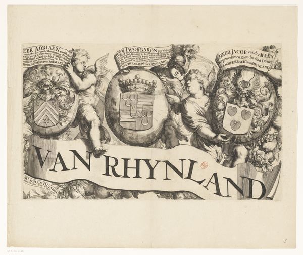
Kaart van het Hoogheemraadschap van de Krimpenerwaard (deel wapenrand) 1683
0:00
0:00
graphic-art, print, engraving
#
graphic-art
#
baroque
#
dutch-golden-age
# print
#
old engraving style
#
pen-ink sketch
#
line
#
decorative-art
#
engraving
Dimensions: height 437 mm, width 525 mm
Copyright: Rijks Museum: Open Domain
This section of a map was made in the Netherlands around 1670, by Johannes Leupenius, using engraving on paper. The fine lines were carved into a metal plate, which was then inked and printed to create the image. What’s fascinating here is the interplay between the visual language of heraldry and the practical need to represent a specific territory. The lions, crests, and scrolling foliage all speak to power and status, while the map itself would have been an essential tool for administering the region. Consider the labor involved in this kind of printmaking. It required great skill and precision, and many hours of work. Yet, the final product was relatively easily reproduced and disseminated, making geographical information more accessible. This engraving isn't just a functional document; it’s a carefully crafted representation of authority, made possible by skilled labor and innovative technology. It shows how the power of images intersects with the power of place.
Comments
No comments
Be the first to comment and join the conversation on the ultimate creative platform.
More like this