drawing, print, watercolor
#
drawing
#
baroque
# print
#
watercolor
#
cityscape
#
history-painting
#
watercolor
Dimensions: height 115 mm, width 168 mm
Copyright: Rijks Museum: Open Domain
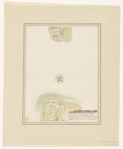
This small, anonymous map depicts the French city of Calais during its bombardment in 1694. It presents us with not just a place, but a dramatic event of military aggression. The visual language is straightforward. Ships line the coast, their cannonballs arcing toward the city. This image was likely produced in the Dutch Republic, a major maritime power and frequent rival of France. Maps like these served a dual purpose. First as records of military conflict, and second as a form of propaganda, shaping public perception of these events. The map presents a specific point of view in the ongoing power struggles of the time. As historians, understanding the context in which maps like these were produced is essential. Examining period documents, military records, and political pamphlets can reveal the biases and agendas at play. Maps are not neutral depictions of space, but powerful cultural objects that reflect the social and political contexts of their creation.
Comments
No comments
Be the first to comment and join the conversation on the ultimate creative platform.
More like this