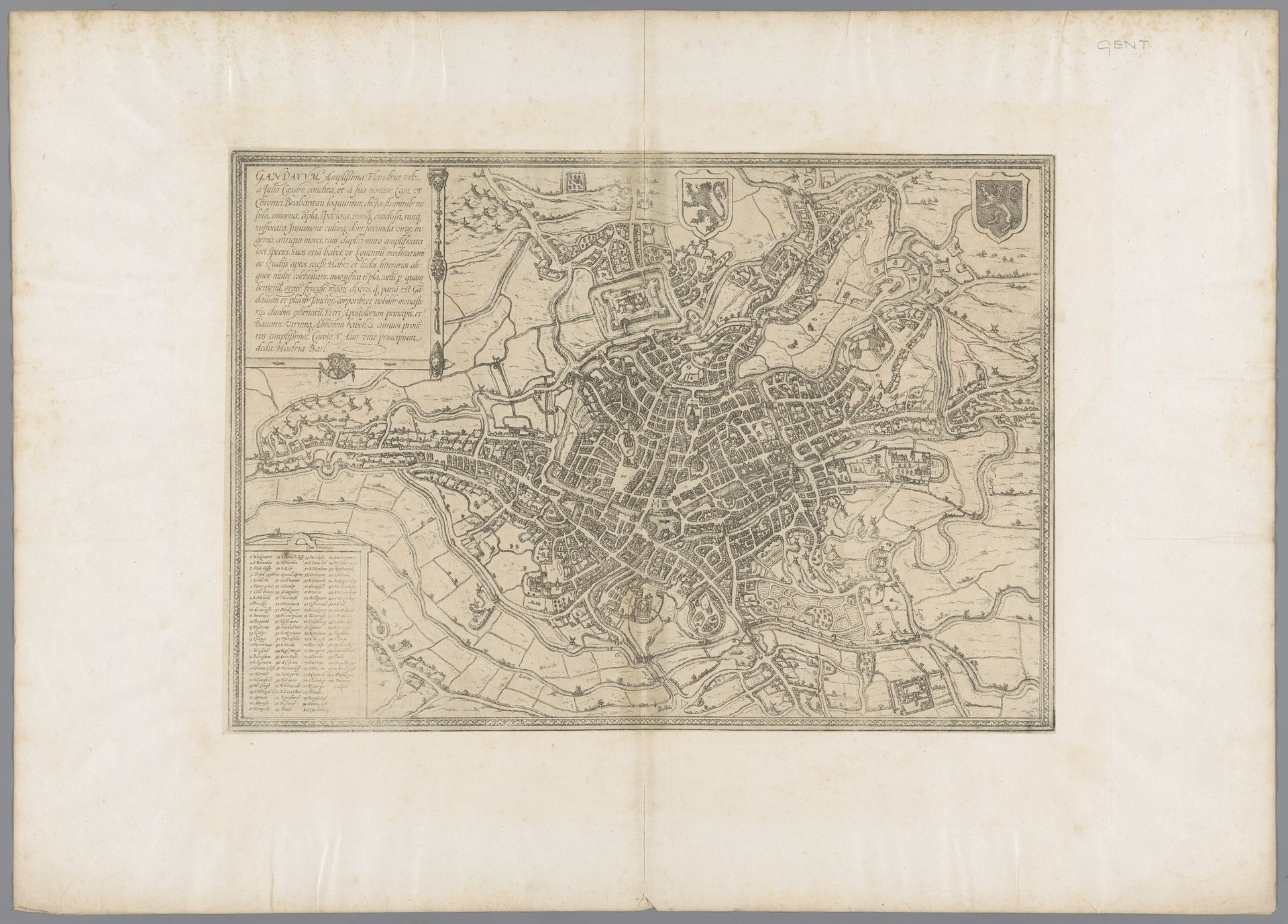
1575
Plattegrond van Gent
Frans Hogenberg
1540 - 1590Location
RijksmuseumListen to curator's interpretation
Curatorial notes
This is Frans Hogenberg’s “Plattegrond van Gent,” an engraving offering a bird's-eye view of the city of Ghent. Hogenberg was part of a generation deeply affected by the religious and political upheavals of the 16th century. The map is more than just a depiction of urban space; it is a representation of power and identity. Ghent, a significant city in the Habsburg Netherlands, was a site of intense religious conflict during this period. The detailed layout of the city, with its fortifications and key buildings, reflects the strategic importance of Ghent in the struggle between Protestant and Catholic forces. Consider how Hogenberg, as an engraver, was instrumental in shaping public perceptions of cities and regions. These maps helped foster a sense of regional and national identity. The emotional impact of seeing one's city represented in such detail must have been profound. Did it inspire pride, fear, or a sense of belonging? What did it mean to those who called Ghent home? This image invites us to reflect on how maps mediate our relationship with place and power.