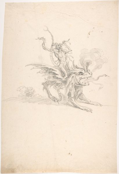
drawing, ink, engraving
#
drawing
#
baroque
#
landscape
#
figuration
#
ink
#
history-painting
#
engraving
Dimensions: height 410 mm, width 298 mm
Copyright: Rijks Museum: Open Domain
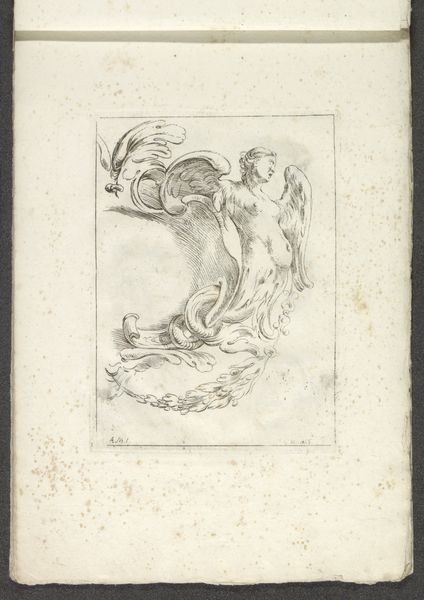
Curator: What a striking image! The monochrome palette and energetic lines really animate it. Editor: It’s…unsettling. There’s so much open space around the central figures, it feels incomplete, or like a fragment of something larger. Curator: You’re looking at "Kaart van het Graafschap Holland en Utrecht (plaat 1)," a drawing in ink and engraving by Jacob Aertsz. Colom, dating back to 1639. It resides here at the Rijksmuseum. Editor: Ah, that context helps. 17th century, then. Immediately I’m drawn to the textural contrast: the meticulous, almost scientific hatching of the waves against the swirling, baroque dynamism of the sea creatures. What was the function of something like this? Was it meant to illustrate some grand maritime narrative, or just a commercial map? Curator: It was one plate of a series mapping Holland and Utrecht. Consider the context of the Dutch Golden Age, its dependence on seafaring trade, colonial exploitation and territorial disputes, the mapping of the known world held immense economic and political power. Depictions of mythological sea creatures, like we see here, naturalize the conquest of foreign lands, marking this seascape both beautiful and violent. The depiction of this man riding a horse pulling a serpent suggests a man subjugating and mastering the power of sea. Editor: Fascinating! Formally, though, there is such an asymmetry here; the eye travels a stark diagonal between the blank upper reaches and the clustered drama in the lower corner, those energetic crosshatched lines denoting form. It’s almost as if Aertsz. is consciously playing with spatial tension to guide our focus. Curator: And perhaps commenting on the limited reach of human dominion? That empty space is ripe for colonial expansion and further exploitation of sea trade. The map served as an object and record of those exploitations. It’s all right there in the line work! Editor: True, every mark tells a story of production, both the artist's and the world's. This has offered me fresh ways of perceiving artistic intentionality as well as how the art becomes embedded in culture. Curator: Likewise, seeing it through your formal perspective illuminates elements I might have missed—a fruitful exchange, I think!
Comments
No comments
Be the first to comment and join the conversation on the ultimate creative platform.
More like this