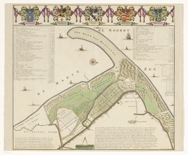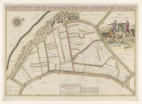
1701
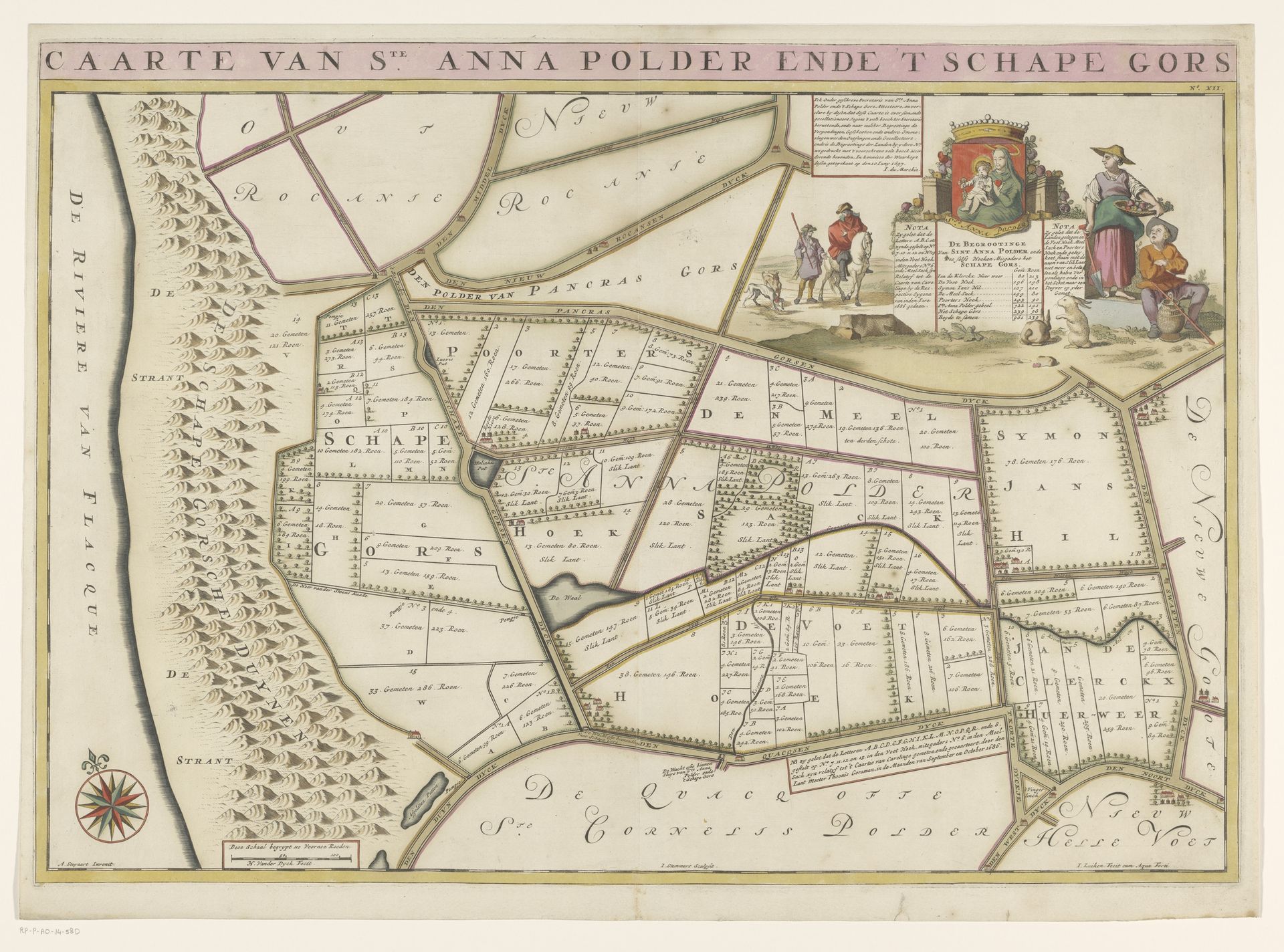
Kaart van de Sint-Annapolder en het Schapengors
Jan Stemmers
@janstemmersLocation
RijksmuseumListen to curator's interpretation
Curatorial notes
This is Jan Stemmers's map of the Sint Anna Polder and the Schapen Gors, an engraving with original hand coloring. The visual experience is dominated by its structured and orderly layout, which is created by the use of lines to depict the land. Patches of green and brown suggest a landscape of cultivated fields, divided and neatly labeled. The map's structure shows us more than just geographical data; it represents control and understanding of the land. The visual elements—the precise lines, the measured divisions—reflect a world seen through a lens of order and rationality. This approach to mapping mirrors a broader cultural desire to impose structure on the natural world, turning it into a landscape of human design. Ultimately, this map invites us to consider the complex interplay between representation and reality. It reminds us that every map is an interpretation, shaped by the values and perspectives of its creator.