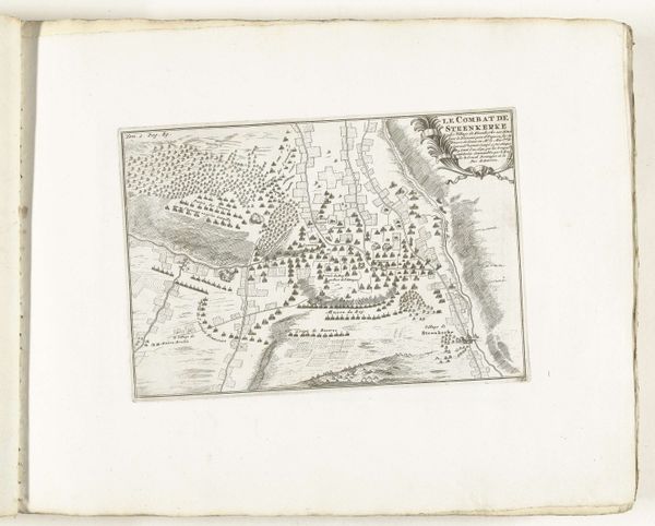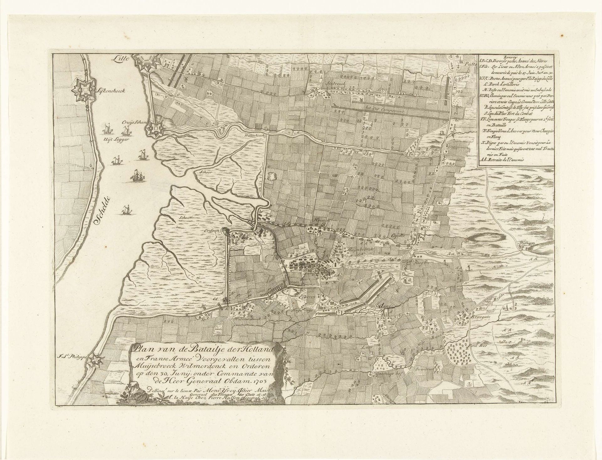
1703
Kaart van de veldslag bij Ekeren, 1703
Anonymous
@anonymousLocation
RijksmuseumListen to curator's interpretation
Curatorial notes
This is an anonymous map depicting the Battle of Ekeren in 1703, rendered with ink on paper. The map represents a pivotal moment in the early 18th century, amidst the War of the Spanish Succession, reflecting the intense power struggles and territorial ambitions of European nations. The Battle of Ekeren involved the Dutch and French armies, the map becomes a canvas of conflict, where the drama of war unfolds across the landscape. This wasn't just a clash of armies; it was a collision of identities, shaped by dynastic ambitions and colonial desires. The map offers more than just geographical data; it gives us a glimpse into the human stories overshadowed by grand narratives of war. It prompts reflection on the cultural and emotional experiences of those affected. Who were the cartographers and how did their backgrounds influence their work? What impact did these conflicts have on the lives of ordinary people? This map connects us to broader themes of conflict, identity, and representation. The emotional weight of historical events subtly renders societal power.