print, engraving
#
baroque
# print
#
geometric
#
cityscape
#
history-painting
#
engraving
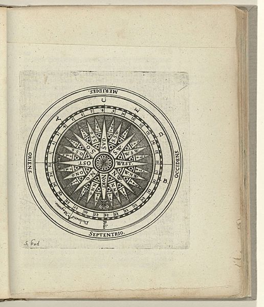
Dimensions: height 365 mm, width 367 mm
Copyright: Rijks Museum: Open Domain
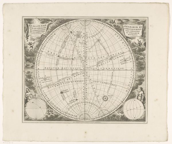
This wind rose was made anonymously around 1702, in the Netherlands, using engraving. In the Dutch Golden Age, this navigational tool wasn't just about direction, it was deeply intertwined with the nation's economic and political ambitions. The visual codes of the map, like the compass rose at its center, pointed towards the Netherlands' dominance in global trade routes. This era was marked by the rise of the Dutch East India Company, a powerful entity that shaped not only commerce but also colonial expansion. The choice of language, with both ancient and modern place names, showed a connection to classical knowledge, reflecting the intellectual climate of the time. The map is also decorated with wind heads and other symbolism. Understanding such an image requires delving into historical archives, trade records, and the narratives of exploration. It reminds us that art, even in the form of a navigational chart, can be a reflection of its social and institutional context.
Comments
No comments
Be the first to comment and join the conversation on the ultimate creative platform.
More like this