print, engraving
# print
#
geometric
#
line
#
cityscape
#
history-painting
#
engraving
Dimensions: height 236 mm, width 335 mm, height 350 mm, width 240 mm
Copyright: Rijks Museum: Open Domain
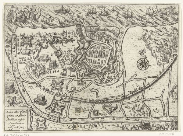
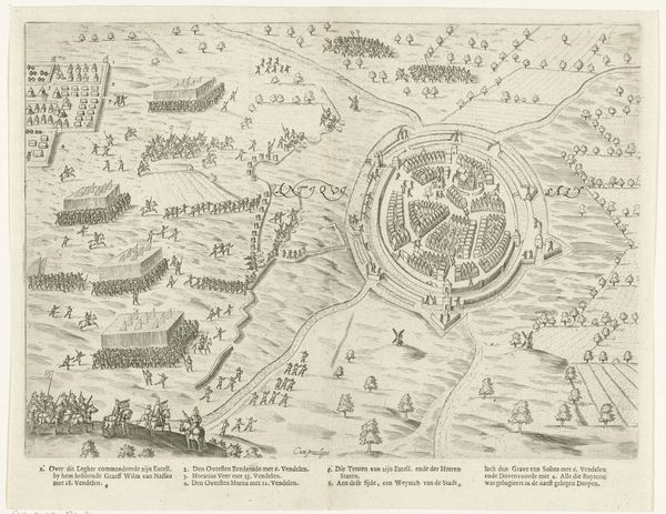
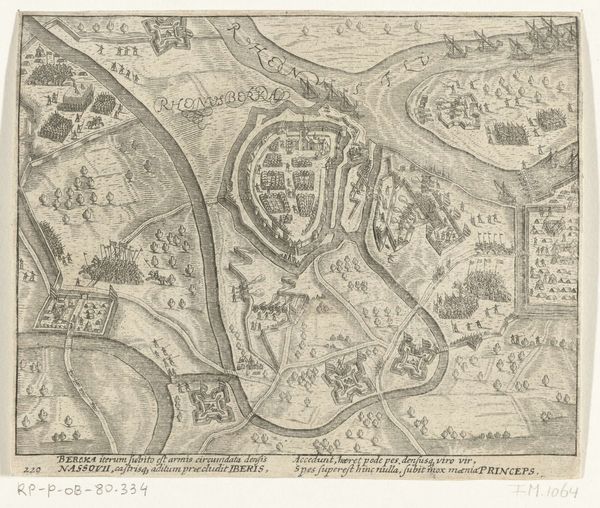
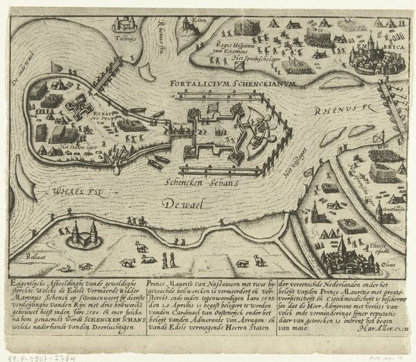
This anonymous engraving depicts the siege and capture of Sluis in 1604, a key moment in the Dutch Revolt against Spanish rule. Maps like this weren't just about geography, they were tools of power, shaping how people understood territory, conflict, and national identity. This image provides a bird's-eye view, showing the positioning of troops, fortifications, and the landscape itself. What's striking is how orderly it all seems, yet beneath this veneer of control lies the messy reality of war and the shifting allegiances of the time. The Dutch revolt wasn’t just a battle between nations; it was a civil war, tearing apart communities and families. Consider the people who lived in Sluis. For them, this wasn't a strategic game but a struggle for survival, caught between warring factions. The map flattens their experience, but we must remember the human cost of these conflicts, and the ways in which individual lives are so often erased from grand historical narratives.
Comments
No comments
Be the first to comment and join the conversation on the ultimate creative platform.
More like this