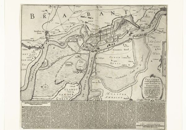
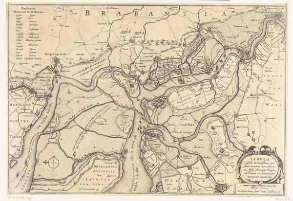
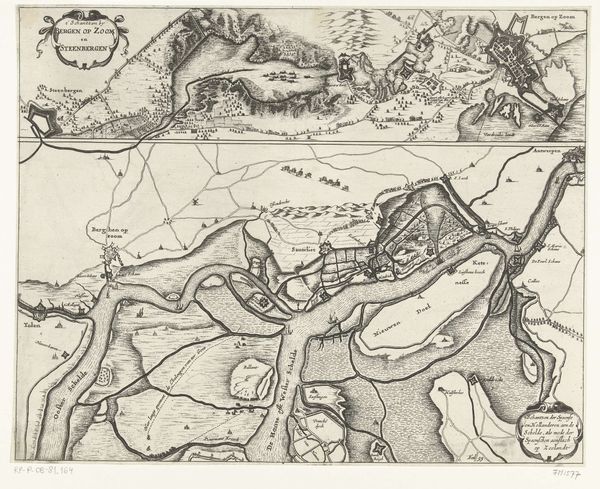
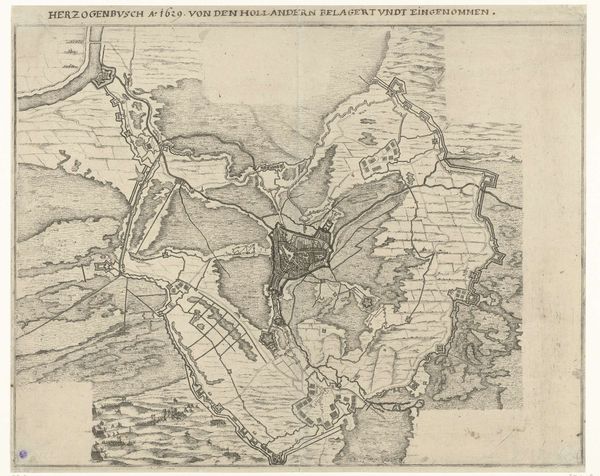
Kaart met de bouw van de Spaanse schans bij Zandvliet, 1627 1627
0:00
0:00
claesjanszvisscher
Rijksmuseum
print, engraving
#
dutch-golden-age
# print
#
cityscape
#
history-painting
#
engraving
Dimensions: height 371 mm, width 428 mm
Copyright: Rijks Museum: Open Domain
Editor: Here we have "Kaart met de bouw van de Spaanse schans bij Zandvliet, 1627," created in 1627 by Claes Jansz. Visscher, an engraving held at the Rijksmuseum. It’s a meticulously detailed map, almost overwhelming in its density. What stories do you think a piece like this is trying to tell? Curator: This map speaks volumes about power, conflict, and representation. Think about what it meant to map territory in the 17th century. It was an act of claiming, of control. This particular map, depicting Spanish fortifications, highlights the ongoing power struggles in the region. It presents a very specific perspective, doesn't it? Who do you think this map was made for, and what was its purpose? Editor: Well, given that it meticulously details Spanish defenses, perhaps it served some strategic military function for their enemies? Curator: Precisely. Consider the Dutch Golden Age context. This map isn't just about geography; it’s about the Dutch Revolt against Spanish rule. It visually participates in that struggle. Maps like this one informed military strategies but also shaped public perception. Whose narrative is being prioritized, and whose is being erased or minimized? How might indigenous perspectives on the land differ from this imposed, structured view? Editor: That's a great point. I was so focused on the "what" of the map – the fortifications, the rivers – that I didn’t consider the "who" and the "why." Curator: Exactly! By dissecting this map, we can see how knowledge itself can be a tool of domination, but also a form of resistance when re-appropriated. We can think about how similar power dynamics persist in cartography today. It also prompts a very serious and thought-provoking issue around land ownership, national identity, and political strategies. Editor: Thank you. I see so many potential research paths now, like looking into the accuracy of the map itself, compared to the landscape today, or studying Dutch map-making techniques of that era! Curator: Exactly! Keep pushing on it, I like where your thoughts are headed.
Comments
No comments
Be the first to comment and join the conversation on the ultimate creative platform.
More like this