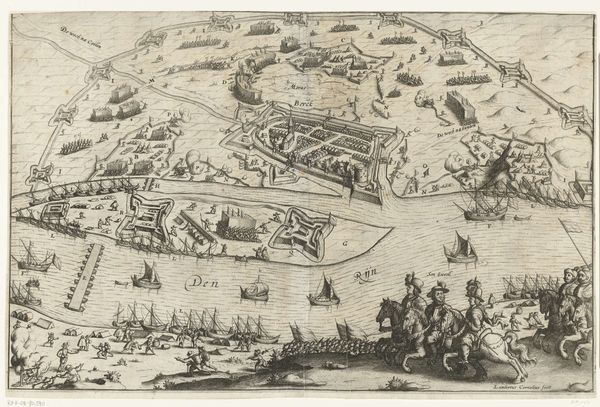
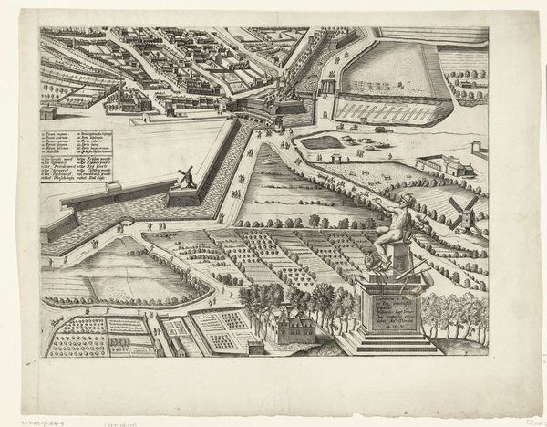
Plattegrond van Amsterdam (blad rechtsonder), 1625 1625
0:00
0:00
balthasarfloriszvanberckenrode
Rijksmuseum
drawing, ink, architecture
#
pen and ink
#
architectural sketch
#
drawing
#
dutch-golden-age
#
ink
#
cityscape
#
architecture
#
realism
Dimensions: height 460 mm, width 534 mm
Copyright: Rijks Museum: Open Domain
Balthasar Florisz. van Berckenrode created this map of Amsterdam in 1625, an etching that offers us a glimpse into the city’s burgeoning maritime power during the Dutch Golden Age. At this time, Amsterdam was becoming a center for global trade, deeply entangled with colonialism. The detailed rendering of ships and port facilities speaks volumes about the city's economic engines and their reliance on maritime activities that, we must remember, were also the routes of exploitation and the transportation of enslaved peoples. What does it mean to look at a map so precise and to understand that it charts not just geography, but the coordinates of a society built on complex power dynamics? The visual of the orderly harbor belies the messier realities of global exchange and human suffering. Consider how maps like these served to legitimize and enable the expansionist ambitions of the Dutch Republic, mapping not just territories, but also futures of colonial control.
Comments
No comments
Be the first to comment and join the conversation on the ultimate creative platform.
More like this