drawing, print, ink, engraving
#
drawing
#
baroque
#
dutch-golden-age
# print
#
landscape
#
ink
#
geometric
#
cityscape
#
engraving
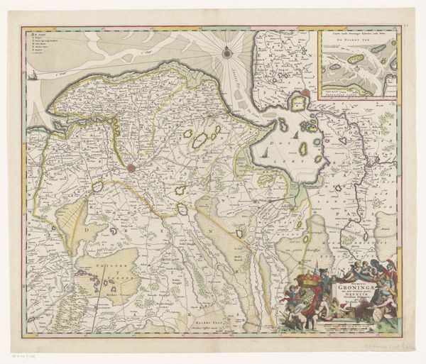
Dimensions: height 498 mm, width 585 mm
Copyright: Rijks Museum: Open Domain
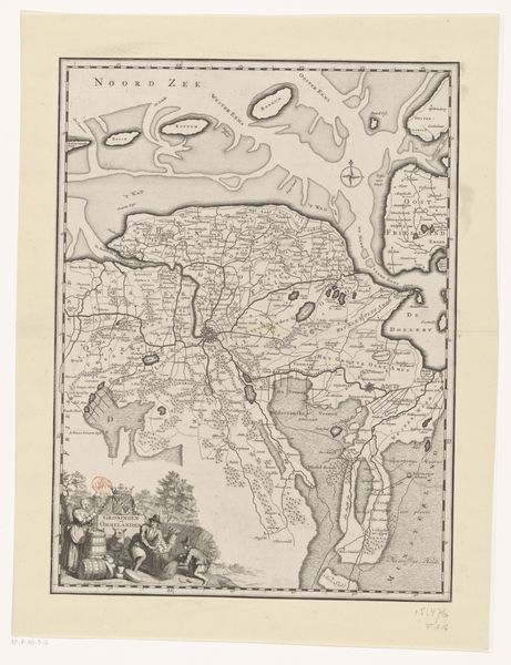
This is Frederik de Wit's map of the province of Groningen, made sometime between 1570 and 1710. It offers us a glimpse into a time when cartography was as much about power and identity as it was about geography. Consider the map not just as a representation of space, but as a statement of Dutch identity during a period of immense change and growth. The detailed rendering of the Groningen province speaks to the importance of local governance and knowledge. The presence of heraldic symbols reminds us of the powerful families who shaped the region. What stories do these symbols tell about who was included and excluded? How does the act of mapping itself define belonging and otherness? While maps like these seem objective, they really reflect the values, biases, and aspirations of their creators. This map is an artifact of a culture grappling with its own image. It prompts us to consider how we create and consume narratives about place, identity, and power.
Comments
No comments
Be the first to comment and join the conversation on the ultimate creative platform.
More like this