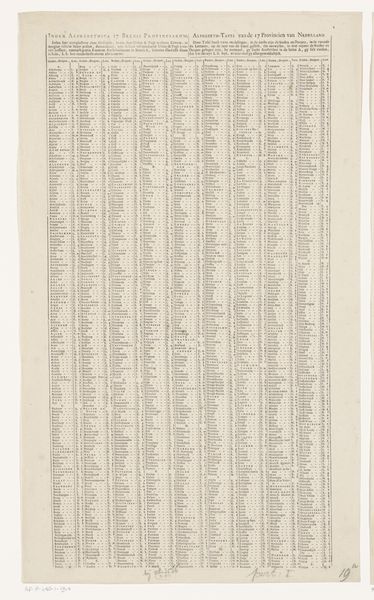
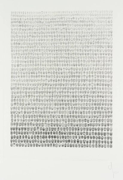
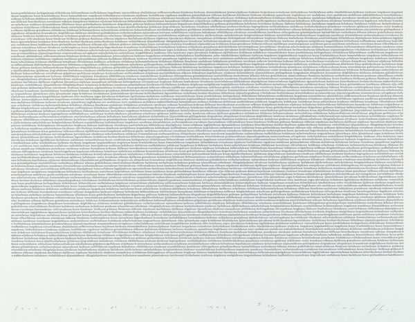
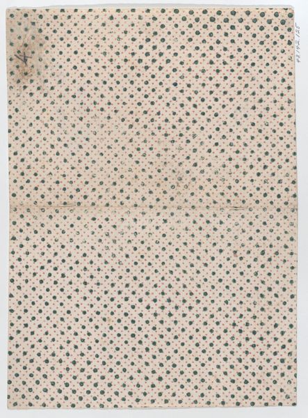
Plaatsregister van alle dorpen en steden te vinden op de bijhorende kaart (rechterblad) after 1708
0:00
0:00
anonymous
Rijksmuseum
drawing, graphic-art, print, paper, engraving
#
drawing
#
graphic-art
# print
#
old engraving style
#
landscape
#
paper
#
pattern design
#
repetitive shape and pattern
#
geometric
#
fabric design
#
repetition of pattern
#
vertical pattern
#
pattern repetition
#
textile design
#
imprinted textile
#
layered pattern
#
engraving
Dimensions: height 475 mm, width 265 mm
Copyright: Rijks Museum: Open Domain
Curator: Here we have an engraving entitled 'Plaatsregister van alle dorpen en steden te vinden op de bijhorende kaart (rechterblad)', which translates to 'Register of all villages and towns to be found on the accompanying map (right sheet)'. Created after 1708, it's a fascinating example of graphic art. Editor: At first glance, it looks incredibly dense. Almost like patterned wallpaper from a distance. It’s a field of tiny inscriptions on paper. I am wondering about access, who it was meant for and how easy it would be to access that information. Curator: Indeed. What is striking is its intended use. This wasn't simply decorative. It's a directory, an early form of geographical database made accessible through print. The context for cartography in the 18th century relates closely with exploration and growing imperial interests. Editor: Absolutely, the proliferation of printed matter democratized knowledge, but also participated in projects of control and classification. Whose places are being registered here? How might this list reflect power dynamics of the time? Was the mapping and cataloging intended for governance or something else? Curator: These are excellent points. It's attributed to "Anonymous," so while we know the style is in line with Carel Allard, tracing a specific intention becomes complex. Was this mapping connected with the development of the East India company, for example? I wonder about who might have had an interest in disseminating this information, and conversely, who would be excluded. Editor: It highlights the social function of these types of art; who got access to knowledge was tied to class, race and gender at the time, even geography. A piece like this encourages a close examination not only of the artistic rendering, but of the wider historical circumstances that facilitated its production. Curator: Very well said. So it seems this seemingly straightforward geographical index is a surprisingly rich source for socio-political inquiry! Editor: It really is! I look at it differently now. It embodies knowledge and the era that created the desire to categorise it all.
Comments
No comments
Be the first to comment and join the conversation on the ultimate creative platform.
More like this