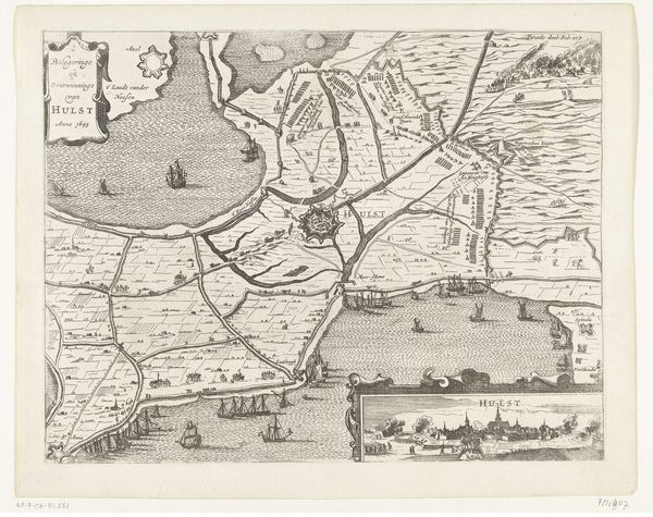
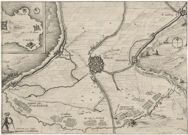
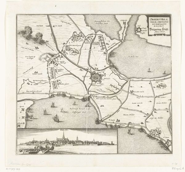
Kaart van het beleg van Hulst door Frederik Hendrik, 1645 1645
0:00
0:00
abrahamdirckszsantvoort
Rijksmuseum
print, engraving
#
baroque
# print
#
landscape
#
cityscape
#
engraving
Dimensions: height 213 mm, width 300 mm
Copyright: Rijks Museum: Open Domain
This is Abraham Dircksz Santvoort's map detailing Frederik Hendrik's siege of Hulst in 1645. Executed with ink on paper, the work presents a bird's-eye view of the conflict, prioritizing structure and layout. The geometric precision used to depict Hulst emphasizes its fortifications, using its radial symmetry to suggest an organized and impenetrable defense. Lines form waterways that dissect the landscape, connecting the besieged city to its surroundings and hinting at strategic chokepoints. The contrast between the ordered cityscape and the more organic rendering of the landscape suggests a tension between human control and the natural world. This cartographic representation extends beyond simple documentation; it serves as a semiotic device, encoding power dynamics. The map doesn't merely show space, but actively constructs it, revealing how space can be both a battleground and a medium for asserting dominance. The tension between line, space and form encourage viewers to consider how such visual organization informs our understanding of military strategy.
Comments
No comments
Be the first to comment and join the conversation on the ultimate creative platform.
More like this