About this artwork
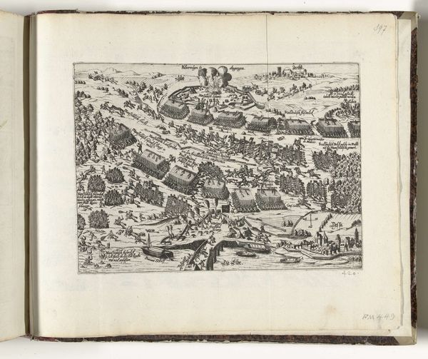
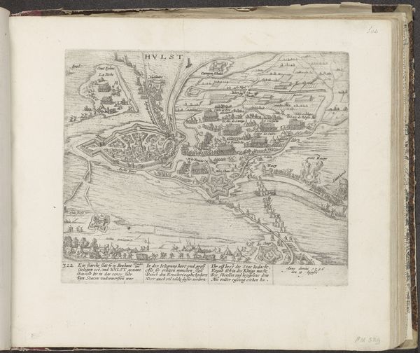
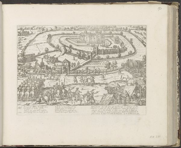
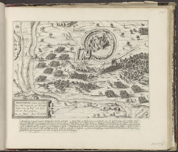
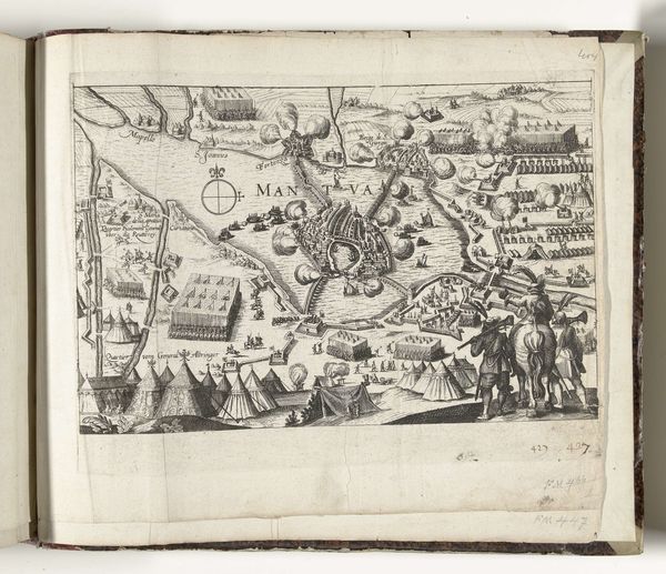
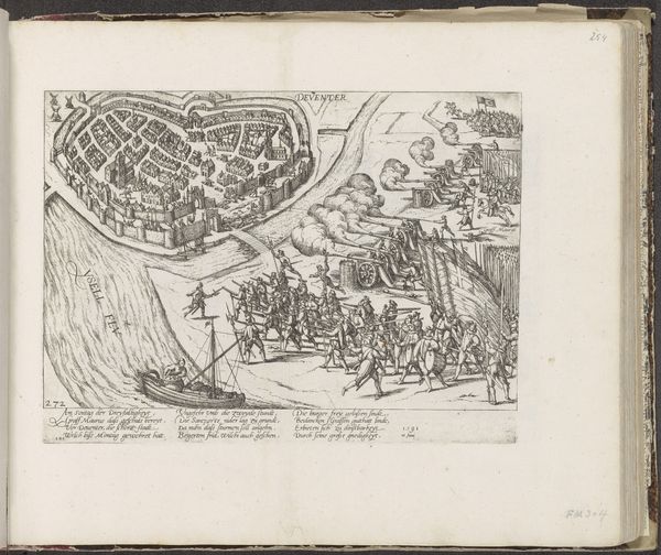
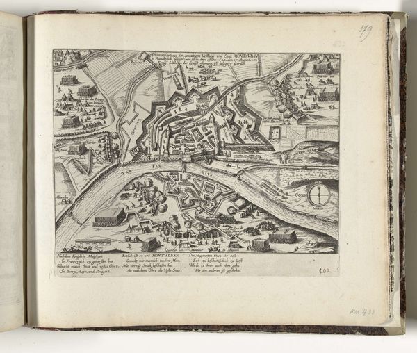
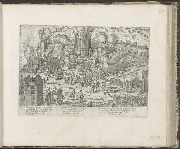
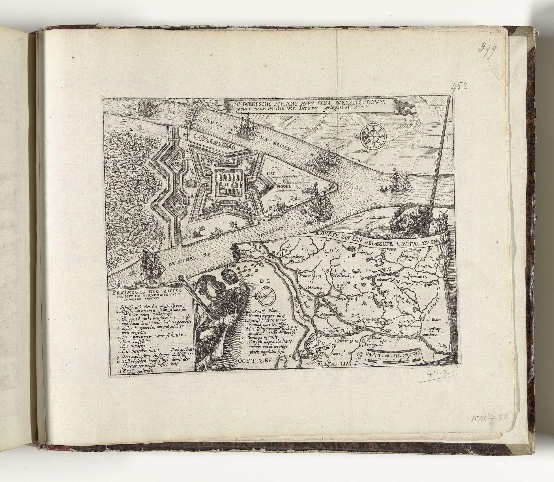
This engraving by Frans Hogenberg depicts a Swedish sconce on the Vistula near Gdansk, dating back to 1626. It’s a period marked by intense religious and political conflict across Europe, a time when cartography was as much about power as it was about place. Notice how the map meticulously details the fortifications and waterways, underscoring the strategic importance of this location during the Polish-Swedish War. But beyond military strategy, consider what it meant to claim and represent territory during this era. Maps like these weren't just neutral depictions; they were tools for asserting dominance, defining boundaries, and shaping identities. They reinforced a sense of belonging for some, while simultaneously excluding or marginalizing others. Think, too, about how this image circulates knowledge and shapes perceptions, influencing how people understood the world and their place within it. Maps are never neutral. They’re always telling a story.
Zweedse schans aan de Weichsel bij Danzig, 1626 1626 - 1628
Frans Hogenberg
1540 - 1590Location
RijksmuseumArtwork details
- Medium
- print, engraving
- Dimensions
- height 206 mm, width 264 mm
- Location
- Rijksmuseum
- Copyright
- Rijks Museum: Open Domain
Tags
baroque
pen sketch
sketch book
landscape
personal sketchbook
sketchwork
ink drawing experimentation
pen-ink sketch
pen work
sketchbook drawing
cityscape
history-painting
storyboard and sketchbook work
sketchbook art
engraving
Comments
No comments
About this artwork
This engraving by Frans Hogenberg depicts a Swedish sconce on the Vistula near Gdansk, dating back to 1626. It’s a period marked by intense religious and political conflict across Europe, a time when cartography was as much about power as it was about place. Notice how the map meticulously details the fortifications and waterways, underscoring the strategic importance of this location during the Polish-Swedish War. But beyond military strategy, consider what it meant to claim and represent territory during this era. Maps like these weren't just neutral depictions; they were tools for asserting dominance, defining boundaries, and shaping identities. They reinforced a sense of belonging for some, while simultaneously excluding or marginalizing others. Think, too, about how this image circulates knowledge and shapes perceptions, influencing how people understood the world and their place within it. Maps are never neutral. They’re always telling a story.
Comments
No comments