1850 - 1881
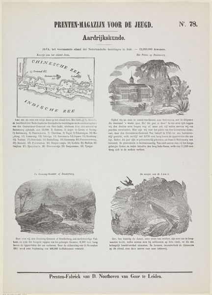
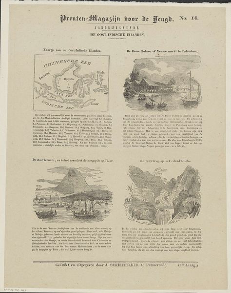
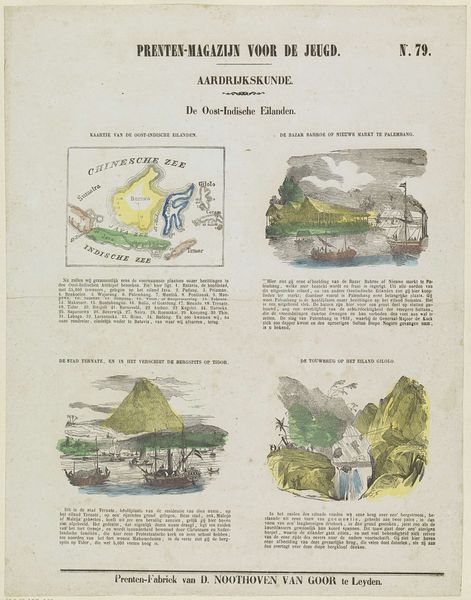
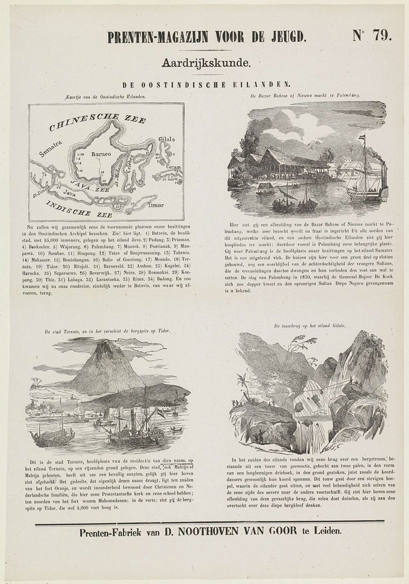
De Oostindische eilanden
Listen to curator's interpretation
Curatorial notes
This is a page from a Dutch geography book, likely made in the mid-19th century by D. Noothoven van Goor, and printed using engraving. It depicts the Dutch East Indies, today known as Indonesia. The map and landscape views offer us an insight into the geographical knowledge that was being disseminated to young people at the time. But more than that, it presents a very particular view of the colony, one that was likely to be consumed by children from privileged backgrounds. How do these images perpetuate the colonial gaze? The inclusion of busy markets and industrious locals, the monumentalising of landscapes; each is a visual code contributing to the idea of the East Indies as an exotic and bountiful land, ripe for exploration and exploitation. To understand the complex relationship between the Netherlands and its former colony, a historian would look at sources like colonial archives, travel writing and educational materials like this print. They all demonstrate how the creation and circulation of images shaped the social and political realities of empire.